Conway continues flood-mitigation work
| Published: 11-27-2023 12:39 PM |
By CHRIS LARABEE
Staff Writer
CONWAY — With two events wrapped up in the last month, Conway’s Municipal Vulnerability Preparedness (MVP) grant project will move to the visioning stage as the town looks for flood-mitigation strategies in the village center.
While the town will continue to hold a few more events heading into the winter and spring, it also will turn its eye toward addressing previous mitigation work, as well as trying to come up with “creative ways” to address flooding in town.
Nicolas Miller, a fluvial geomorphologist, or river scientist, and consultant for the town, said the goal of the project is two-fold. The groups working on the project want to share knowledge with the public about the watershed and they want to ensure the town is resilient to a changing climate.
“Part of this project is expanding and updating some hydraulic modeling we did previously and we’re going to look at what’s doing the flooding and elevated flood hazards in the center of Conway and look at some alternatives,” Miller said. “We’re trying to get ahead of some of this infrastructure.”
The projects are being funded by a $279,000 MVP grant from the state and are being done in partnership with Field Geology Services, GZA GeoEnvironmental and the Franklin Regional Council of Governments (FRCOG), all of which have “been amazing and have put in a lot of hard work and enthusiasm,” Town Administrator Veronique Blanchard said.
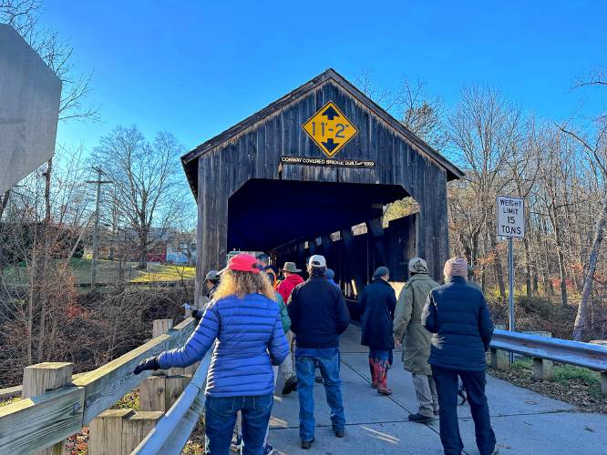
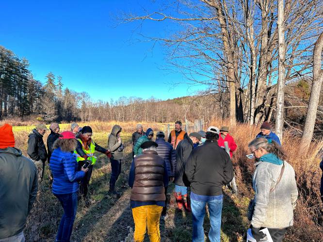
Before the flood-mitigation work, though, both Conway and Ashfield residents were treated to an outdoor harvest meal in October and on Nov. 18 a large group took a walking and bus tour around the town’s watershed, as they learned what sort of climate change risks the town may be facing in the future as well as getting a view of some of the areas hit hard by July’s rainfall.
Article continues after...
Yesterday's Most Read Articles
 Political newcomer defeats Shores Ness for Deerfield Selectboard seat
 South County Senior Center opts not to renew church lease after rift over LGBTQ program
 More than 130 arrested at pro-Palestinian protest at UMass
 As I See It: Between Israel and Palestine: Which side should we be on, and why?
 Moratoriums on large-scale solar, battery storage passed in Northfield
 Bridge of Flowers in Shelburne Falls to open on plant sale day, May 11
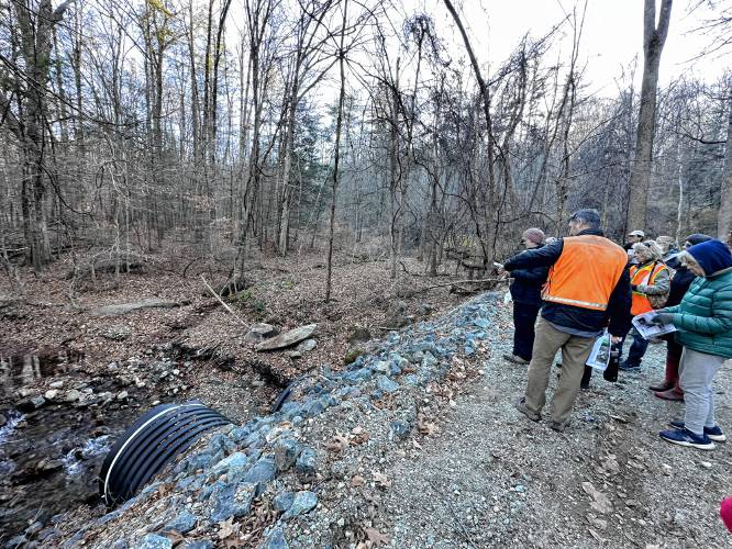
The dinner welcomed more than 100 residents and about 35 people joined the walking/bus tour of the South River watershed. Stops on the tour included the Pumpkin Hollow Brook and at areas along the South River.
The emphasis on the tour, Miller said, was to familiarize residents with areas of the town at risk of flooding and providing some historical and scientific knowledge on how these risks came to be.
“We talked about the aspects of being in a town where there’s so much history and part of the issue being the settlement patterns in New England,” Miller said, highlighting how the town’s steep hillsides with narrow valleys forced people to “build their town next to the river,” which is “in the space the river should occupy for its corridor.”
Residents also were shown the South River Meadow, which is a flood-mitigation project that was completed several years ago and has proven to be effective in reconnecting the river’s floodplain and stabilizing eroding banks. Boulder deflectors were also accumulate sediment by diverting flow toward the river’s main channel.
Looking to the future, Miller said an example of areas to examine is the nearly 100-year-old bridge on Main Street spanning the South River because it often ends up “influencing the flooding and basically dams up the river during a really big event.” Work like that, however, will need the help of the Massachusetts Department of Transportation because the bridge is part of Route 116.
From here, Blanchard said Miller and the other groups working on the process will come up with some conceptual ideas and will present them to residents in the spring, where people will vote on the best ideas for Conway to pursue.
“The idea is the community needs to give input on what they think the best solution is,” Blanchard said. “It’s trying to get the correct information and communicate to the community and get them involved.”
Additionally, Miller is expected to host a presentation on the river watershed for Ashfield and Conway residents at the Conway Grammar School sometime in January.
Chris Larabee can be reached at clarabee@recorder.com or 413-930-4081.

 Retired police officer, veteran opens firearms training academy in Millers Falls
 No surprises in Wendell election
 New Salem election ushers in new Selectboard member
