
Latest News
 My Turn: Saving planet Greenfield
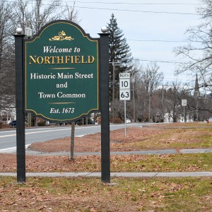 Survey shows Northfield residents want new development — but not near their homes
 Ashfield considers seeking ‘Climate Leader’ designation
 Man granted parole for role in 2001 deaths of 2 Dartmouth College professors
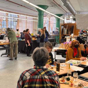 LaunchSpace’s ReMake Festival returning for second year in Orange
 Gun buyback event collects 195 unwanted firearms
 Quabbin region studied for MWRA expansion
 Prices up, sales down in early spring housing market
 Real Estate Transactions: April 19, 2024

New owners look to build on Thomas Memorial Golf & Country Club’s strengths
TURNERS FALLS — Members of the Snow family have added another golf course to their portfolio and have already begun work on cosmetic improvements.Kyle and Kelly Snow, along with Kyle’s parents Edward Snow Jr. and Kerrilynn Snow, bought the Thomas...

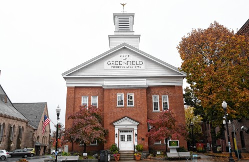
Greenfield City Council approves borrowing $1.18M for Main Street redesign, sewer repairs
GREENFIELD — City Council approved a combined $1.18 million in borrowing for the Main Street redesign project and for significant sewer system repairs aimed to bring the city in compliance with a state Department of Environmental Protection consent...
 Business Briefs: April 19, 2024
 PHOTO: Double eagle
 Greenfield Notebook: April 19, 2024
 West County Notebook: April 18, 2024
Sports

High schools: Abigail Schreiber’s hit propels Frontier softball past Greenfield, 3-2
It wasn’t looking good for the Frontier softball team heading into the bottom of the sixth inning against Greenfield on Thursday. The two-time defending state champs held a 2-0 lead, but the Redhawks were able to get a run back in the sixth. Seventh...
 Baseball: Frontier handles Greenfield 12-2 in five-inning victory (PHOTOS)
 The Real Score: Curveballs and casinos rarely save cities
 High schools: Frontier girls tennis picks up 5-0 win over Turners (PHOTOS)
 Florence’s Gabby Thomas gearing up for 2024 Paris Olympics
Opinion

Gary Seldon: Solar Roller Earth Day River Ride
The Solar Roller Earth Day River Ride, a protest of Northfield Mountain Pumped Storage (NMPS), will gather April 20 at 9 a.m. on the Greenfield Common. Join our bicycling, walking, (paddling anyone?) protest and rallies. Details at...
 Mitch Speight and Joan Marie Jackson: City should follow constitutional ruling on property takings
 Columnist Johanna Neumann: Reaping the rewards of rooftop solar
 My Turn: Let’s leave miracle of trees well enough alone
 Ben Tobin: Another educational song and dance

Business

Cleary Jewelers plans to retain shop at former Wilson’s building until 2029
GREENFIELD — More than a year after she was told her business would need to vacate its storefront in the former Wilson’s Department Store, Cleary Jewelers owner Kerry Semaski said she plans to keep her shop at its current location until July 2029...
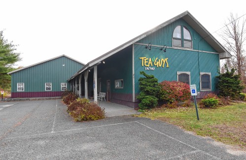 Tea Guys of Whately owes $2M for breach of contract, judge rules
 Primo Restaurant & Pizzeria in South Deerfield under new ownership
 Patrons can ‘walk down memory lane’ at Sweet Phoenix’s new Greenfield location
 Post-pandemic hardship prompts Between The Uprights closure in Turners Falls
e-Edition
Arts & Life

Sounds Local: Spring is singer-songwriter season: A host of local performers celebrate new work
We are fortunate to live in an area where we can experience all types of music, and when it comes to singer-songwriters, we are fortunate to have so many talented ones living among us. Any given weekend, you can head out to one of the local breweries...
 Crunch time for matzo: An easy-to-make sweet treat that’s Passover Seder-friendly
 Spotlight on women in classical music: Brick Church Music Series’s season comes to a close, April 28-29, with Champlain Trio
 Ready for their close-up: Pothole Pictures announces a season of curated film screenings, live music and $1 popcorn
 You’re up next: Western Mass open mic scene heats up post-pandemic
Obituaries
 Judith Fuhring Seelig
Amherst, MA - Judith (Fuhring) Seelig passed away peacefully at Cooley Dickinson Hospital on October 21, 2023 after a brief illness. She was surrounded by friends and family with music and ... remainder of obit for Judith Fuhring Seelig
 Richard F. Delphia
Ashfield, MA - Richard F. Delphia, 84, passed away at Baystate Medical Center in Springfield on Tuesday, April 16, 2024, of complications from a fall. Dick was born in Ludlow, MA on Aug... remainder of obit for Richard F. Delphia
 Mary Lou Barton
Leyden, MA - Mary Lou (Johnson) Barton, 74, of Leyden MA, took the Lord's hand on April 16, 2024, surrounded by her loving family at home. She was born in Brattleboro, VT on September 7, 19... remainder of obit for Mary Lou Barton
Judith M. Lively
Greenfield, MA - Judith Mae (Phillips) Lively, 85, of Wells St., passed away on Tuesday April 9, 2024. Judy was born in Greenfield on June 5, 1938 the daughter of Walter and Mildred (Ch... remainder of obit for Judith M. Lively