A kayaker’s chronicle: Part two of three: Water’s out below Turners Falls dam; farmer explains exemptions to Clean Water Act
| Published: 07-28-2023 2:54 PM |
Editor’s note: This is part two of a three-part series chronicling the current state of the Connecticut River as it runs through Massachusetts, in light of the recent U.S. Supreme Court decision to limit the Clean Water Act. In part two, writer Anna Laird Barto paddles from the Turners Falls Dam to the Coolidge Memorial Bridge. Barto began her journey before the recent catastrophic flooding throughout the region.
My journey is stopped short by the Turners Falls Dam. The concrete monolith is actually two dams – the Montague Dam and the Gill Dam – joined in the middle by an island of jagged rock.
Where I stand near the chain link fence on the Montague side, the river is more full of rocks than water. Most of the water is being diverted to the Turners Falls Canal and funneled downstream to the Cabot Hydroelectric Generating Station. The dam does occasionally release extra water for white water paddling, but today I have no choice but to portage my kayak three miles downstream to the Poplar Street Access.
As part of its bid for a new 50-year license with the Federal Energy Regulatory Commission, the dam’s operator, FirstLight Hydro Generating Co., has pledged to release more water into this bypass section of the river, particularly in the spring, when shad, lamprey and Atlantic salmon migrate upstream.
“But then in the summer, (the water) cuts back pretty dramatically,” said Kelsey Wentling of the Connecticut River Conservancy.
“And we’re really concerned that the proposed minimum flow is not enough water to support fluvial fish species and not enough water to even get a kayak through. It’s not even enough water to really cover some of the riverbed. So we’re pretty concerned about that and how it impacts the quality of habitat and water right there below the dam.”
Since I live a few blocks away, I’m already familiar with the no-man’s land between the canal and the river. In the shady river bottom, the unhoused camp among the graffiti-splattered ruins of abandoned mill buildings – this despite the bright yellow signs warning of rapidly rising waters. Just downstream, behind the “Patch” neighborhood, you can pick up a trail to the Rock Dam. This natural pool, where migratory fish spawn, holds significance for anglers past and present.
But without enough water, it may become part of the collective memory, the same as the Great Falls where the dam now stands.
Article continues after...
Yesterday's Most Read Articles
 Authorities ID victim in Greenfield slaying
 State records show Northfield EMS chief’s paramedic license suspended over failure to transport infant
 Police report details grisly crime scene in Greenfield
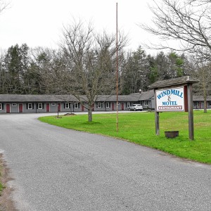 New buyer of Bernardston’s Windmill Motel looks to resell it, attorney says
 McGovern, Gobi visit development sites in Greenfield, Wendell
 High schools: Seventh-inning rally helps Turners Falls softball edge Frontier 6-3 (PHOTOS)
Fish and boaters aren’t the only ones affected by the fluctuating water levels. Farmers like Ryan Voiland, of Red Fire Farm in Montague, rely on the river to irrigate their crops. Last summer, Voiland’s irrigation pumps were drowned 10 to 15 times after sudden surges in water level.
“I suppose that the river fluctuates naturally depending on the rainfall and things to some extent,” he said. “But what happens here seems totally artificial based on what they’re letting through or not.”
Farmers have also found themselves on the front lines of the debate over the Clean Water Act.
The National Farm Bureau Federation (NFBF) applauded the recent U.S. Supreme Court decision in Sackett v. EPA. The decision stipulates that intermittent streams and pools do not qualify as protected Waters of the United States (WOTUS) under the Clean Water Act.
“Nearly any activity that occurs within a WOTUS requires a permit (unless the activity is exempt),” the NFBF statement reads, “which can take years to obtain and cost tens or even hundreds of thousands of dollars. A simple misjudgment by a farmer in determining whether a low spot is or isn’t WOTUS could trigger huge civil fines and even criminal punishment.”
I was unable to reach the Massachusetts FBF for comment.
How do these regulations impact the day-to-day operations of farmers in the Valley?
On a misty June morning, I follow Voiland along a muddy ditch on his 110-acre farm on the banks of the Connecticut and Sawmill Rivers.
“If you look at the way the water comes off the hillside over here,” Voiland said, gesturing to the wooded embankment to our right, “there’s three or four streams that essentially come down in different little rivulets off this hill. At least some of them are intermittent streams.”
Voiland and his family have been farming in Montague Meadows since 2009, but the farmstead itself dates back to the 1800s. He said the previous owners, probably back in the 1950s or 1960s, built this ditch to intercept these streams. One end of the ditch drains into a culvert that carries the water under Meadow Road, and eventually into the Sawmill. The other end collects in a small retention pond, also built by previous owners.
“This land would be much less productive if we had four streams running through all these fields, which is what would’ve been,” he said. “We probably would lose half the land in terms of this agricultural production.”
After Voiland’s pond overflowed in 2001, inundating nearby fields, he had no difficulty obtaining permission from the town Conservation Commission to dredge and rebuild the ditch. He said he got the green light because he was doing maintenance on “agriculturally active” property. He’s unsure if today’s regulations would allow the kind of modifications the previous owners made back in the 1950s or 1960s.
Scott Jackson is an extension professor in the Department of Environmental Conservation at the University of Massachusetts Amherst, and has also served on the Whately Conservation Commission. He said the problem is not with the law, but with misunderstandings.
“What they think is government overreach is actually the government trying to be pragmatic about the fact that farmers work the land,” Jackson said. “Farmers who are allowed to clean out their ditches, that’s an exempt activity. Farmers are allowed to irrigate, that’s an exempt activity. They’re allowed to clear the edges of vegetation that would shade their fields, even if it includes wetlands.”
Jackson said that by and large, the federal government defers to the states to do the regulating, and Massachusetts has had a very effective wetlands protection act since 1983. “Fortunately the Supreme Court decision doesn’t affect the Massachusetts laws,” he said.
Boston attorney David Ingram, writing in the June 30 edition of the National Law Review, said that the Sackett decision could make it easier to develop some smaller Massachusetts wetlands, especially in municipalities without local wetland bylaws. According to data compiled by the Massachusetts Association of Conservation Commissions, most communities in the Valley do have wetland protections on the books, including Greenfield, Amherst and Northampton.
“I think the more we’re able to talk to farmers about this – and I think there’s a lot more of that dialogue that’s happened,” Jackson said, “the more it’s really calming down those controversies, because the law, while it’s very good at protecting wetlands, also has a very well-thought-through exemption for agriculture, and that helps reduce some of those conflicts.”
Sunderland Islands
The current is swifter below the dam. I intentionally ground my kayak on a narrow spit of land near Second Island to photograph a family of bald eagles that alighted on the pebbly beach.
The islands, which are owned and managed by the Massachusetts Division of Fisheries and Wildlife, are off-limits to visitors from January to July, when young eagles are fledging. Judging by their plumage, mottled brown with flecks of white, these juveniles are around 6 months old. They tag along behind their white-headed parents, swooping and screeching up and down the river.
In addition to bald eagles, the islands provide habitat for the endangered short-nose sturgeon. Along this stretch of river I also encountered a fisherman wrangling a carp the size of a small dog.
Coolidge Memorial Bridge
Paddling downstream through Hatfield, Hadley and Northampton, I see boats and jet skis pulled up alongside sandy beaches. Families and young people lounge next to coolers of cold beverages between dips in the river.
This was not something I saw growing up in the 1980s. Thanks to the Clean Water Act and Massachusetts environmental laws, today the Connecticut River is mostly safe for swimming and boating. The exception is after heavy rainstorms, when bacteria levels are elevated. We also now have tools to help us know when the water is safe for recreation, including an online resource from the Connecticut River Conservancy.
As I approach the Coolidge Bridge, and the end of the northern segment of my cross-state paddle, cumulus clouds gather on the horizon and reflect onto the surface of the water. Little do I know that within hours, my journey will be halted by a devastating rainfall event that will test the resiliency of our watershed.
Originally from Amherst, Anna Laird Barto lived everywhere from Wisconsin to Mexico before returning to the Valley. She currently lives in Montague and works as a freelance writer and a family support worker at a local nonprofit. She holds an MFA from Emerson College in Boston and has published fiction and nonfiction in various publications including YES! Magazine, Explore, Fodor’s Travel, Hobart and Wanderlust Journal. Visit her at annalairdbarto.com or @annalairdbarto.
]]>
 Speaking of Nature: Indulging in eye candy: Finally, after such a long wait, it’s beginning to look like spring is here
 Celebrating ‘Seasonings’: New book by veteran preacher and poet, Allen ‘Mick’ Comstock
 Faith Matters: How to still the muddy waters of overthinking: Clarity, peace and God can be found in the quiet spaces
 A time for every purpose under heaven: Free sing-a-long Pete Seeger Fest returns to Ashfield, April 6