
Tracing Origins: Interesting remnants of the Ice Age in Pioneer Valley
| Published: 12-01-2017 12:53 PM |
Franklin County and the North Quabbin Region have a lot to offer residents and visitors — beautiful scenery, outdoor recreation of all sorts and interesting crafts and products.
But for those who appreciate and enjoy history, the area has special interest.
A quick look at this aspect of the region should begin with an examination of the geological history of the portion of the Connecticut Valley that runs through the county. The valley played host to hundreds of species of dinosaurs during their heyday on the planet, and the peculiar nature of the soil here, coupled with periodic floods, created one of the largest collections of fossil dinosaur footprints in the world.
These footprints are found embedded in layers of sedimentary rock along the Connecticut and are collected in museums and exhibitions from Greenfield to Hartford.
Long after the dinosaurs had died out, glaciers bulldozed their way down the valley during the last Ice Age, scraping and planing the Earth’s surface. Much of the soft sandstone that makes up the underlying rock in the valley was scraped away, but one interesting remnant is South Sugarloaf Mountain in South Deerfield.
Its companion, North Sugarloaf, is made of tough, hard basalt — a remnant of an ancient lava flow. When the glacial bulldozer carved out the valley, it was tough enough to resist the grinding of the mile-high ice.
It protected the sandstone in its wake, diverting the ice around it and leaving South Sugarloaf — 450 feet above the valley floor — as a monument to the power of the ice.
When the glaciers melted, they left an enormous lake — Lake Hitchcock — behind. Walled up between rocky ridges and blocked at the south end by a huge earth and gravel dike near Middletown, Conn., the lake took centuries to drain.
Article continues after...
Yesterday's Most Read Articles
 Serious barn fire averted due to quick response in Shelburne
 Bridge of Flowers in Shelburne Falls to open on plant sale day, May 11
 Political newcomer defeats Shores Ness for Deerfield Selectboard seat
 Roundup: Pioneer baseball wins Suburban League West title following 2-0 win over Hopkins
 As I See It: Between Israel and Palestine: Which side should we be on, and why?
 Employee pay, real estate top Erving Town Meeting warrant
It left behind deposits of clay, sand and gravel, which can be seen throughout the valley — usually as they are being mined by contractors for road and building construction.
First humans
When the first immigrants arrived in the area, they were migrating Indians seeking the rich diversity of food and fertile soil evident here.
Estimates differ greatly on when they actually first arrived, but it was at least 10,000 years ago.
Those first settlers adapted their lifestyle to the demands of the region, clearing large areas of woodland to allow planting of crops. Using stone tools, fire and patience, they gradually turned many heavily forested parts of the county into fields.
The rich soil left behind by Lake Hitchcock, and subsequent millennia of forestation, was fertilized by fish — alewives from the rivers and streams — and planted in corn, squash, beans, gourds and watermelons.
The area around Barton Cove, near the Great Falls, was so important to Indian tribes in Vermont, New York, New Hampshire and Massachusetts that it was declared a truce area. Tribes that were at war agreed to camp there during the shad run season without quarreling.
The highway known as the Mohawk Trail (Route 2), which runs from Boston to North Adams, is situated roughly along the old trails used by Indians moving to and from Barton Cove.
Tim Blagg is a local historian who teaches history at Greenfield Community College. He wrote this brief account of Franklin County’s history while he was editor of the Recorder, a position he held for much of the last four decades.
]]>
 Speaking of Nature: Indulging in eye candy: Finally, after such a long wait, it’s beginning to look like spring is here
 Celebrating ‘Seasonings’: New book by veteran preacher and poet, Allen ‘Mick’ Comstock
 Faith Matters: How to still the muddy waters of overthinking: Clarity, peace and God can be found in the quiet spaces
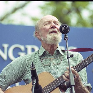 A time for every purpose under heaven: Free sing-a-long Pete Seeger Fest returns to Ashfield, April 6